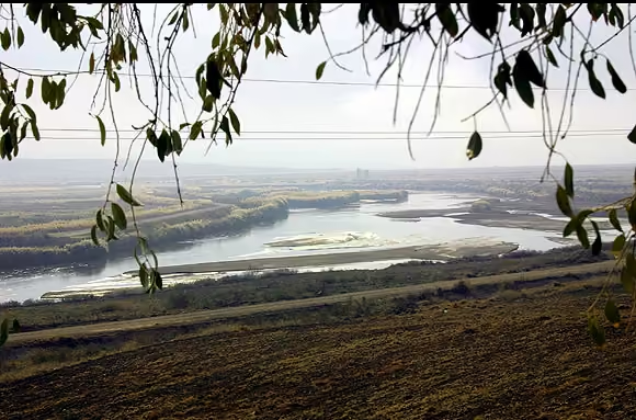
Kızılırmak River
Turkey
1,355
kilometres
River length
Two of 124 — one shows its kilometres, the other hides it. Say whether the hidden one is more or less and keep going. A tie counts as correct; one wrong answer ends the run, including a near miss within 10%.
A river is the one landmark nobody sees whole. A mountain can be taken in from a distance and a city from a hill, but a river is only ever met at one point on its way somewhere else: a bridge, an embankment, a stretch of towpath. How long it is has to be taken on trust, and what people trust instead is how important it seems — how many capitals sit on it, how often it turns up in history, whether a border follows it.
That is a fine way to rank rivers by fame and a poor way to rank them by length. The Thames runs through more of English history than any other river and is shorter than the Severn. The Jordan is 252 kilometres long. The Rubicon, whose crossing started a civil war, is 35.
Why the intuition fails
Fame gathers where people do, and people gather on the lower reaches of rivers, where the land is flat, the water is navigable and the sea is close. The rivers of Europe's great cities are short by world standards because Europe is small and has coasts on three sides; nothing in it has room to run far. The Rhine, the busiest waterway in Europe, is under a third the length of the Lena.
The Lena is the better lesson. Siberia has several of the longest rivers on Earth, and few people live along most of their length. Their names mean little outside Russia, because what makes a river famous is what happens on its banks, and for thousands of kilometres at a time nothing much does.
Naming makes it worse. Which of two rivers keeps its name after they meet was decided by whoever settled there first, not by which was longer. The Irtysh is a tributary of the Ob and runs some six hundred kilometres further than it. The Missouri, which joins the Mississippi above St. Louis, is within a few dozen kilometres of it on the record, and measured from the Missouri's source the combined river is one of the longest in the world.
What the data is and what it is not
The list leans towards rivers written about in many languages, and that means Europe, and Russia in particular. Fifteen of the rivers here flow through Russia and nowhere else. Germany is well represented by rivers most British players could not place. Britain, by the same measure, has two: the Severn and the Thames.
Every length is in kilometres, and every river in the list states it in kilometres, so no figure had to be converted. The thing that nearly went wrong was the definition of a river. At a slightly lower bar the same query returns a lake in Japan and a desert valley in Jordan, both of which Wikidata classes somewhere in the family tree of rivers, and both of which would have been dealt as a card with a length.
Questions
- What does length mean here?
- The length Wikidata records for the river, in kilometres, from its source to its mouth. Both ends are choices. A river rarely has one obvious source, and where a river becomes an estuary or a delta is a matter of definition, so two careful surveys of the same river can differ by hundreds of kilometres. The figure here is the one on the record, not a ruling on which survey was right.
- Why is my river missing?
- The likeliest reason is that it has fewer than 70 pages across Wikimedia’s projects, which is the bar for recognisable. At the September 2026 retrieval the Trent, the Clyde and the Shannon all fell short of it. After that: its record gives more than one length with nothing to say which is meant, as the Murray’s and the St. Lawrence’s do.
- How accurate are the lengths?
- Less accurate than they look. A river’s length depends on the scale of the map it is measured on, because a finer map follows more of every bend, and no two sources measure at the same scale. Some records give a length to the ten metres, most to the kilometre, and many are round hundreds. Treat any two rivers within a few per cent of each other as a coin toss that the record has settled.
- Why does a card show a region instead of countries?
- Where a river crosses more than three countries, the card names the region instead, because a list of nine countries does not fit under a name and would not help anyone guess. Otherwise it names the countries in the order the river flows through them. The line is written by hand: the record lists every country in a river’s basin, in no order, including some it never enters.
- Does the pack change?
- Rarely. A river’s recorded length changes when someone remeasures it or settles on a different source, and either is a correction rather than a drift, so the pack is marked evergreen rather than given a refresh timer. A regeneration re-runs the same query and rewrites only what changed.
- Can I play it without JavaScript?
- You can read all of it and see the opening pair, because the page is built as HTML before anything runs. Guessing needs JavaScript, since there is no server to send a guess to.
Where the figures come from
Wikidata, under CC0 1.0. Retrieved 2026-09-22.
Rivers with at least 70 Wikimedia sitelinks, so every item is recognisable on sight (brief §15). Lengths are taken from the best-ranked statement and only where it is stated in kilometres. A river whose best-ranked statements still give more than one length — usually the river alone beside the river with its longest headwater — is left out rather than given a number we would have to choose. The countries beneath each name are written by hand, in the order the river flows.
Image credits
Nile (Northeast Africa) — Vyacheslav Argenberg, CC BY 4.0, source.
Amazon (Peru, Colombia and Brazil) — Neil Palmer/CIAT, CC BY-SA 2.0, source.
Yangtze River (China) — Tan Wei Liang Byorn, CC BY 3.0, source.
Yellow River (China) — fading, CC BY-SA 3.0, source.
Paraná River (Brazil, Paraguay and Argentina) — Nepenthes, CC BY-SA 3.0, source.
River Congo (Central Africa) — Bsm15, CC BY-SA 3.0, source.
Mekong River (China and Southeast Asia) — Vyacheslav Argenberg, CC BY 4.0, source.
Lena River (Russia) — "synchroswimr"/Stacy , Minneapolis, CC BY 2.0, source.
Irtysh (China, Kazakhstan and Russia) — Petar Milošević, CC BY-SA 3.0, source.
Niger River (West Africa) — upyernoz from Haverford, USA, CC BY 2.0, source.
Mississippi River (USA) — NPS photo, Public domain, source.
Missouri River (USA) — Tim Kiser ( w:User:Malepheasant ), CC BY-SA 2.5, source.
Ob (Russia) — Ondřej Žváček, CC BY 2.5, source.
Volga (Russia) — Insider, CC BY-SA 3.0, source.
Yenisei (Russia) — Vyacheslav Bukharov, CC BY-SA 4.0, source.
Yukon River (Canada and USA) — Anthony DeLorenzo from Whitehorse, Yukon, Canada, CC BY-SA 2.0, source.
Indus River (China, India and Pakistan) — Sameerusmani, CC BY-SA 3.0, source.
Rio Grande (USA and Mexico) — Andreas F. Borchert, CC BY-SA 4.0, source.
Brahmaputra River (China, India and Bangladesh) — Deepraj, CC BY 2.5, source.
Danube (Central and Eastern Europe) — Gabor Eszes ( UED77 ), CC BY-SA 3.0, source.
Amur River (Russia and China) — User:Refrain, Public domain, source.
Salween River (China, Myanmar and Thailand) — 瑞丽江的河水, CC BY-SA 4.0, source.
São Francisco River (Brazil) — Cleferson Comarela, CC BY-SA 3.0, source.
Euphrates (Turkey, Syria and Iraq) — YG01, CC BY 4.0, source.
Paraguay River (Brazil, Paraguay and Argentina) — Ilosuna, CC BY 1.0, source.
Amu Darya (Central Asia) — Petar Milošević, CC BY-SA 4.0, source.
White Nile (Uganda, South Sudan and Sudan) — User DEMOSH on flickr.com, CC BY 2.0, source.
Zambezi River (Southern Africa) — Diego Delso, CC BY-SA 4.0, source.
Ganges (India and Bangladesh) — Wedstock 2011, CC BY-SA 2.0, source.
Tocantins River (Brazil) — Etore.Santos, Public domain, source.
Ural River (Russia and Kazakhstan) — Public domain, source.
Pearl River (China) — Daniel Berthold, CC BY-SA 3.0, source.
Arkansas River (USA) — Public domain, source.
Colorado River (USA and Mexico) — Thomas Wolf, www.foto-tw.de, CC BY-SA 3.0, source.
Dnieper (Russia, Belarus and Ukraine) — Dmitry A. Mottl, CC BY-SA 3.0, source.
Kasai River (Angola and DR Congo) — DominiqueWisler, CC0, source.
Rio Negro (Colombia, Venezuela and Brazil) — Ymichel, CC BY-SA 3.0, source.
Syr Darya (Central Asia) — Petar Milošević, CC BY-SA 3.0, source.
Orange River (Lesotho, South Africa and Namibia) — Martin Cígler, CC BY-SA 3.0, source.
Irrawaddy River (Myanmar) — Vyacheslav Argenberg, CC BY 4.0, source.
Orinoco River (Venezuela and Colombia) — Venecon at the English-language Wikipedia, CC BY-SA 3.0, source.
Kolyma (Russia) — Димон17, CC BY-SA 4.0, source.
Columbia River (Canada and USA) — Cacophony, CC BY-SA 3.0, source.
Chenab River (India and Pakistan) — PP Yoonus (ppyoonus@yahoo.co.in), Attribution, source.
Don (Russia) — High Contrast, CC BY-SA 2.0 de, source.
Tigris (Turkey, Syria and Iraq) — Dûrzan cîrano, CC BY-SA 3.0, source.
Pechora (Russia) — Лидия Чипсанова, CC BY-SA 4.0, source.
Kama (Russia) — Niklitov, CC BY-SA 4.0, source.
Uruguay River (Brazil, Argentina and Uruguay) — Deyvid Setti e Eloy Olindo Setti, CC BY-SA 3.0, source.
Blue Nile (Ethiopia and Sudan) — by Giustino, CC BY 2.0, source.
Angara (Russia) — Vyacheslav Bukharov, CC BY-SA 4.0, source.
Limpopo River (Southern Africa) — Department of Defense. American Forces Information Service. Defense Visual Information Center. 1994, Public domain, source.
Mackenzie River (Canada) — CambridgeBayWeather, CC BY-SA 3.0, source.
Indigirka (Russia) — LoLand, CC BY-SA 3.0, source.
Okavango River (Angola, Namibia and Botswana) — Teo Gómez, Public domain, source.
Ohio River (USA) — Antony-22, CC BY-SA 4.0, source.
Magdalena River (Colombia) — Bernard Gagnon, CC BY-SA 4.0, source.
Sutlej (China, India and Pakistan) — Darshan Simha, CC BY 2.0, source.
Oka (Russia) — A.Savin, CC BY-SA 3.0, source.
Volta River (Burkina Faso and Ghana) — Siyajkak, CC BY-SA 3.0, source.
Darling River (Australia) — Tannin, CC BY-SA 3.0, source.
Godavari River (India) — Siyavash, CC BY-SA 3.0, source.
Madeira River (Bolivia and Brazil) — Wilson Dias/ABr, CC BY 3.0 br, source.
Krishna River (India) — Zeman, CC BY-SA 3.0, source.
Yamuna (India) — Gérard Janot, CC BY-SA 3.0, source.
Benue River (Cameroon and Nigeria) — Ashinze, CC BY-SA 4.0, source.
Kura River (Turkey, Georgia and Azerbaijan) — Vyacheslav Argenberg, CC BY 4.0, source.
Kızılırmak River (Turkey) — Public domain, source.
Dniester (Ukraine and Moldova) — Guttorm Flatabø from Leikanger, Norway, CC BY 2.0, source.
Rhine (Western Europe) — Jörg Braukmann, CC BY-SA 4.0, source.
Gambia River (Guinea, Senegal and Gambia) — United States government, Public domain, source.
Elbe (Czechia and Germany) — che, CC BY-SA 2.5, source.
Aras River (Caucasus) — Well-read MountainMan, CC BY-SA 4.0, source.
Ubangi River (Central Africa) — Michael Walsh, CC BY 3.0, source.
Donets (Russia and Ukraine) — Vizu, CC BY-SA 3.0, source.
Senegal River (Mali, Mauritania and Senegal) — Gregor Rom, CC BY-SA 4.0, source.
Daugava (Russia, Belarus and Latvia) — Alex Zelenko, CC BY-SA 4.0, source.
Tagus River (Spain and Portugal) — Sempreconvosco, CC BY-SA 4.0, source.
Loire (France) — LPLT, CC BY-SA 3.0, source.
Tisza (Central Europe) — Lily15, CC BY-SA 3.0, source.
Prut (Ukraine, Moldova and Romania) — Varga Attila, CC BY-SA 3.0, source.
Meuse (France, Belgium and the Netherlands) — Pierre Lavaurs, Public domain, source.
Sava (Balkans) — 12345danNL, CC0, source.
Neman (Belarus, Lithuania and Russia) — Ziko van Dijk, CC BY-SA 4.0, source.
Douro River (Spain and Portugal) — Turismo En Portugal, CC BY 2.0, source.
Kuban (Russia) — Pavel.Shulekin, CC BY-SA 4.0, source.
Oder (Czechia, Poland and Germany) — Grzegorz Kilian, CC BY-SA 3.0, source.
Yalu River (China and North Korea) — Ffggss, CC BY-SA 4.0, source.
Rhône (Switzerland and France) — Chiugoran, CC BY-SA 3.0, source.
Warta (Poland) — Kolanin, CC BY-SA 4.0, source.
Seine (France) — User Arpingstone on en.wikipedia, Public domain, source.
Drava (Central Europe) — Hbabuka, CC BY-SA 4.0, source.
Potomac River (USA) — Jan Kronsell, CC BY-SA 3.0, source.
Guadalquivir (Spain) — Hispalois, CC BY-SA 3.0, source.
Po (Italy) — Adrian Michael, CC BY 2.5, source.
Garonne (Spain and France) — Didier Descouens, CC BY-SA 4.0, source.
Moselle (France, Luxembourg and Germany) — Areks, CC BY-SA 3.0, source.
Main (Germany) — Roland Bergmann Dipl. Ing. (FH) Architekt, Public domain, source.
Inn (Switzerland, Austria and Germany) — Aconcagua, CC BY-SA 3.0, source.
Hudson River (USA) — Dan DeLuca, CC BY 2.0, source.
Moskva River (Russia) — Anton Zelenov, CC BY 3.0, source.
Weser (Germany) — Presse03, CC BY-SA 3.0, source.
Vltava (Czechia) — Dmitry A. Mottl, CC BY-SA 4.0, source.
Adige (Italy) — Adbar, CC BY-SA 3.0, source.
Tiber (Italy) — AngMoKio, CC BY-SA 2.5, source.
Spree (Germany) — Túrelio, CC BY-SA 2.5, source.
Bío Bío River (Chile) — Eneas De Troya from Mexico City, México, CC BY 2.0, source.
Chao Phraya River (Thailand) — Chainwit., CC BY-SA 4.0, source.
Neckar (Germany) — Berndt Fernow, Public domain, source.
Scheldt (France, Belgium and the Netherlands) — Jean-Pol Grandmont, CC BY 2.5, source.
River Severn (Wales and England) — Christian David, CC BY-SA 4.0, source.
River Thames (England) — Zxb, CC BY-SA 2.0 at, source.
Aare (Switzerland) — Taxiarchos228, CC BY-SA 3.0, source.
Isar (Austria and Germany) — Richard Bartz, CC BY-SA 3.0, source.
Río de la Plata (Argentina and Uruguay) — Jacques Descloitres, MODISRapid Response Team, NASA/GSFC, Public domain, source.
Jordan River (Middle East) — Bill Rice from Flat Rock, MI, USA, CC BY 2.0, source.
Arno (Italy) — Hagai Agmon-Snir حچاي اچمون-سنير חגי אגמון-שניר, CC BY-SA 4.0, source.
Shatt al-Arab (Iraq and Iran) — user:aziz1005, Public domain, source.
Neva (Russia) — Kuffdam at Russian Wikipedia, CC0, source.
Rubicon (Italy) — Stefano Bolognini, Attribution, source.

.jpg)


.JPG)

.jpg)

.jpg)


_-_2.jpg)
.jpg)


_shore.jpg)


.jpg)


.jpg)


.jpg)


_-_0_2.jpg)


.jpg)


.jpg)


_-_img_06.jpg)


.jpg)


