Mountain height
Two of 112 — one shows its metres, the other hides it. Say whether the hidden one is more or less and keep going. A tie counts as correct; one wrong answer ends the run, including a near miss within 10%.
Nobody has seen how high a mountain is. What the eye takes in is how far it rises above wherever the eye happens to be, and that is a different number with a different cause. A peak that climbs straight out of the sea looks colossal. One that stands on a high plateau looks like a hill with ideas. The figure that goes into atlases, meanwhile, is measured from a sea that may be a thousand miles away and was never in the picture at all.
So the height a mountain has in memory is mostly how it looked from the bottom, and how often it has been photographed from there. That makes some comparisons in this pack feel unfair. Snowdon and Table Mountain are, on the record, the same height to the metre. Teide, on a holiday island, is within a hundred metres of Mount Fuji. Mount Rushmore is four hundred metres higher than Ben Nevis.
Why the intuition fails
A mountain's elevation is the sum of two things, and people only see the second. The first is the ground it stands on. Mount Rushmore is a granite outcrop in the Black Hills, which stand on the high plains of South Dakota, so a modest peak inherits a large number. Ben Nevis gets no such help: it starts at the head of a sea loch, and its 1,345 metres are climbed from almost exactly nothing.
The second distortion is fame. The mountains everybody knows are known for something other than height — an eruption, a scripture, a flag at the top. Vesuvius buried Pompeii and is not quite as high as Ben Nevis. Mount Sinai carries more history than anything in the Alps and is lower than the railway station on the Jungfrau.
The third is that a truly high mountain rarely looks it. From Everest base camp, already more than five thousand metres up, the summit is less than four kilometres above the tents, and a neighbour can block it out entirely. Kilimanjaro, rising alone from the savannah, looks taller than it is; Everest, crowded by other giants, looks shorter.
What the data is and what it is not
The list leans towards mountains that have been written about in many languages, and what gets written about is volcanoes, holy mountains and the Himalaya. Thirteen of the world's fourteen peaks above eight thousand metres are here. So are a good many modest hills, because a pilgrimage or a battle does more for a mountain's page count than another thousand metres of rock.
The fourteenth eight-thousander is Annapurna, and it is missing because most of what has been written about it is about the massif, which the record counts as a range rather than a mountain. The summit itself has too few pages of its own to clear the bar.
What nearly went wrong was Mauna Loa, whose record states its height twice: once in metres and once in feet. Read without its unit, that is a mountain of 13,679 metres, the highest on Earth by some distance. Only figures stated in metres are used, which leaves it one height and a place in the pack.
Questions
- What does height mean here?
- The elevation of the summit above sea level, as Wikidata records it, in metres. It is not how far the mountain rises from its own foot, which is the height you see when you stand beneath it and is often a small fraction of the figure. Mauna Kea starts on the sea floor and is taller than Everest measured that way; on this card it is just over 4,200 metres, because only the part above the sea counts.
- Why is my mountain missing?
- The likeliest reason is that it has fewer than 50 pages across Wikimedia’s projects, which is the bar for recognisable. After that: its record gives more than one height with nothing to say which is current; or it is one of five items left out by hand because their figure is not a summit’s height above sea level, among them a volcano on Mars. Annapurna is missing for a stranger reason, which the page below explains.
- How accurate are the heights?
- As accurate as the survey behind each record, and the surveys are not equal. Everest’s figure is given to the centimetre and Ben Nevis’s to the millimetre, while others are a round number with no survey date beside it. A height stated more precisely is not necessarily more right: it is a measurement of a pile of rock and snow, and the snow moves.
- Why does a card show two countries?
- Because the summit is on the border between them, and naming only one would be taking a side the mountain has not. The country line is written by hand rather than taken from the record, which lists the People’s Republic of China where a player says China, and the United Kingdom where a player says Scotland or Wales.
- Does the pack change?
- Rarely. A mountain’s height moves when it is resurveyed or when it erupts, and either is an event rather than a drift, so the pack is marked evergreen rather than given a refresh timer. The list barely ages either. A regeneration re-runs the same query and rewrites only what changed.
- Can I play it without JavaScript?
- You can read all of it and see the opening pair, because the page is built as HTML before anything runs. Guessing needs JavaScript, since there is no server to send a guess to.
Where the figures come from
Wikidata, under CC0 1.0. Retrieved 2026-09-22.
Mountains, volcanoes and other summits with at least 50 Wikimedia sitelinks, so every item is recognisable on sight (brief §15). Heights are elevation above sea level, taken from the best-ranked statement and only where it is stated in metres. A mountain whose best-ranked statements still give more than one height is left out rather than given a number we would have to choose. Five items Wikidata counts as mountains are left out by hand, because the figure is not a summit’s height above sea level: a volcano on Mars, a walled compound in Jerusalem, two islands in the Indian Ocean, and an Indian hill station whose elevation is the town’s rather than its peak’s. The country beneath each name is written by hand.
Image credits
Mount Everest (Nepal and China) — shrimpo1967, derivative work by Papa Lima Whiskey 2, CC BY-SA 2.0, source.
K2 (Pakistan and China) — Zacharie Grossen, CC BY-SA 4.0, source.
Kangchenjunga (Nepal and India) — My Discovery, CC BY 2.0, source.
Lhotse (Nepal and China) — Jamie O'Shaughnessy ( talk · contribs ), Public domain, source.
Cho Oyu (Nepal and China) — Uwe Gille, CC BY-SA 3.0, source.
Dhaulagiri (Nepal) — Vyacheslav Argenberg, CC BY 4.0, source.
Manaslu (Nepal) — Pratapgrg, CC BY-SA 4.0, source.
Nanga Parbat (Pakistan) — Atif Gulzar, Copyrighted free use, source.
Gasherbrum (Pakistan and China) — Dr. Olaf Rieck ( http://www.olafrieck.de ), CC BY-SA 3.0, source.
Broad Peak (Pakistan and China) — Kogo, CC BY-SA 3.0, source.
Gasherbrum II (Pakistan and China) — Public domain, source.
Shishapangma (China) — Swinelin at English Wikipedia, Public domain, source.
Tirich Mir (Pakistan) — KaleemUllah550, CC BY-SA 4.0, source.
Gangkhar Puensum (Bhutan) — Christopher J. Fynn, CC BY-SA 4.0, source.
Ismoil Somoni Peak (Tajikistan) — Jaan Künnap, CC BY-SA 4.0, source.
Noshaq (Afghanistan and Pakistan) — Louis Meunier, CC BY 3.0, source.
Jengish Chokusu (Kyrgyzstan and China) — Chen Zhao, CC BY 2.0, source.
Khan Tengri (Kazakhstan, Kyrgyzstan and China) — Chen Zhao, CC BY 2.0, source.
Aconcagua (Argentina) — Bjørn Christian Tørrissen, CC BY-SA 4.0, source.
Ojos del Salado (Chile and Argentina) — Janne Corax, CC BY-SA 2.5, source.
Llullaillaco (Chile and Argentina) — Attribution, source.
Mount Kailash (China) — Jean-Marie Hullot, CC BY-SA 4.0, source.
Chimborazo (Ecuador) — Eduardo Navas, CC BY-SA 2.0, source.
Denali (USA) — Denali National Park and Preserve, Public domain, source.
Mount Logan (Canada) — Gerald Holdsworth, Public domain, source.
Cotopaxi (Ecuador) — camilogaleano.com, CC BY-SA 4.0, source.
Mount Kilimanjaro (Tanzania) — Chris 73 / Wikimedia Commons, CC BY-SA 3.0, source.
Mount Elbrus (Russia) — Jason Blue-Smith, CC BY-SA 2.0, source.
Pico de Orizaba (Mexico) — México en Fotos, CC BY-SA 2.0, source.
Nevado del Ruiz (Colombia) — U.S. Geological Survey, Public domain, source.
Mount Kenya (Kenya) — Ruud Zwart, CC BY-SA 2.5 nl, source.
Shkhara (Georgia and Russia) — ilan molcho from israel, CC BY 2.0, source.
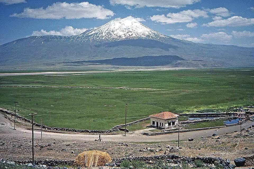
Mount Ararat (Turkey) — W. Bulach, CC BY-SA 4.0, source.
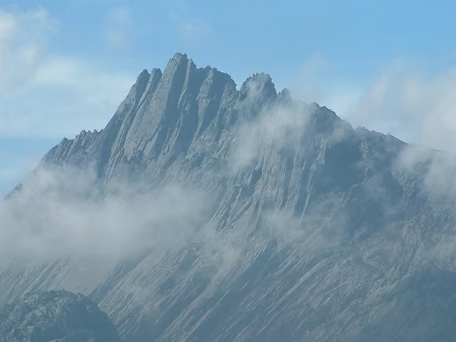
Puncak Jaya (Indonesia) — Alfindra Primaldhi, CC BY 2.0, source.
Mont Blanc (France and Italy) — Christian David, CC BY-SA 4.0, source.
Klyuchevskaya Sopka (Russia) — Tamten at cs.wikipedia, Public domain, source.
Dufourspitze (Switzerland) — TobiasBender, CC BY-SA 3.0, source.
Belukha Mountain (Russia) — Vitecek, CC BY-SA 3.0, source.
Matterhorn (Switzerland and Italy) — Gianluca Miscione, CC BY-SA 4.0, source.
Mount Whitney (USA) — Geographer ( talk · contribs ), CC BY 1.0, source.
Mount Rainier (USA) — Walter Siegmund, CC BY-SA 3.0, source.
Mauna Kea (Hawaii, USA) — Eric Guinther, CC BY-SA 3.0, source.
Mauna Loa (Hawaii, USA) — Gordon Joly, CC BY-SA 3.0, source.
Jbel Toubkal (Morocco) — Public domain, source.
Jungfrau (Switzerland) — Roland Zumbühl, Arlesheim, CC BY-SA 3.0, source.
Mount Kinabalu (Malaysia) — kallerna, CC BY-SA 4.0, source.
Mount Cameroon (Cameroon) — Eric Joel MAMA NKE, CC BY-SA 4.0, source.
Mount Aragats (Armenia) — Armenak Margarian, CC BY-SA 4.0, source.
Eiger (Switzerland) — qwesy qwesy, CC BY 3.0, source.
Yushan Main Peak (Taiwan) — James Ho, CC BY-SA 2.0, source.
Grossglockner (Austria) — DennisPeeters, Public domain, source.
Mount Erebus (Antarctica) — Richard Waitt, U.S. Geological Survey, Public domain, source.
Mount Fuji (Japan) — 名古屋太郎, (edited by Hannes_24 ), CC BY-SA 3.0, source.
Aoraki / Mount Cook (New Zealand) — W. Bulach, CC BY-SA 4.0, source.
Teide (Tenerife, Spain) — Thomas Wolf, www.foto-tw.de, CC BY-SA 3.0 de, source.
Semeru (Indonesia) — Pambudiyoga, CC BY-SA 4.0, source.
Mulhacén (Spain) — Nilsf, CC BY-SA 3.0, source.
Mount Nyiragongo (DR Congo) — Cai Tjeenk Willink (Caitjeenk), CC BY-SA 3.0, source.
Aneto (Spain) — Avh, CC BY-SA 3.0, source.
Mount Etna (Italy) — Jacopo Werther, CC BY-SA 4.0, source.
Zugspitze (Germany and Austria) — Tuxyso, CC BY-SA 4.0, source.
Mount Apo (Philippines) — Bro. Jeffrey Pioquinto, SJ, CC BY 2.0, source.
Musala (Bulgaria) — Public domain, source.
Mount Olympus (Greece) — kallerna, CC BY-SA 4.0, source.
Merapi (Indonesia) — Rosalia.silaban, CC BY-SA 4.0, source.
Triglav (Slovenia) — Andrej Jakobčič, CC BY-SA 3.0, source.
Tambora (Indonesia) — Jialiang Gao (peace-on-earth.org), CC BY-SA 3.0, source.
Mount Hermon (Syria and Lebanon) — Almog, Public domain, source.
Mount Roraima (Venezuela, Brazil and Guyana) — Paolo Costa Baldi, CC BY-SA 3.0, source.
Parícutin (Mexico) — Jim Luhr, Smithsonian Institution, Public domain, source.
Mount Ruapehu (New Zealand) — W. Bulach, CC BY-SA 4.0, source.
Baekdu Mountain (China and North Korea) — Bdpmax, CC BY-SA 3.0, source.
Mount Asama (Japan) — Yu.nakai, CC BY-SA 3.0, source.
Mount St. Helens (USA) — Lyn Topinka, Public domain, source.
Rysy (Poland and Slovakia) — Makarczuk at Polish Wikipedia, CC BY-SA 2.5, source.
Mayon Volcano (Philippines) — Marisa Mercado, CC BY-SA 4.0, source.
Mount Sinabung (Indonesia) — Public domain, source.
Mount Parnassus (Greece) — Electron08, CC BY-SA 3.0, source.
Mount Sinai (Egypt) — Gerd Eichmann, CC BY-SA 4.0, source.
Adam's Peak (Sri Lanka) — Rehman Abubakr, CC BY-SA 4.0, source.
Mount Kosciuszko (Australia) — John Wormell, CC BY-SA 4.0, source.
Mount Nemrut (Turkey) — Bjørn Christian Tørrissen, CC BY-SA 3.0, source.
Kebnekaise (Sweden) — Carl Månsson, CC BY 2.0, source.
Hoverla (Ukraine) — Olexdj, Public domain, source.
Mount Athos (Greece) — Dave Proffer, CC BY 2.0, source.
Mont Ventoux (France) — NielsB, CC BY-SA 3.0, source.
Mount Rushmore (USA) — Thomas Wolf, www.foto-tw.de, CC BY-SA 3.0, source.
Grímsvötn (Iceland) — Roger McLassus, CC BY-SA 3.0, source.
Mount Tai (China) — Charlie fong, Public domain, source.
Hekla (Iceland) — Hansueli Krapf, CC BY-SA 3.0, source.
Pinatubo (Philippines) — Wildfire2383, Public domain, source.
Mount Pelée (Martinique, France) — Public domain, source.
Ben Nevis (Scotland) — Loek037, CC BY-SA 3.0, source.
Mount Vesuvius (Italy) — pietro scerrato, CC BY 3.0, source.
Kīlauea (Hawaii, USA) — Brocken Inaglory, CC BY-SA 3.0, source.
Sakurajima (Japan) — Takobou at Japanese Wikipedia, CC BY-SA 3.0, source.
Table Mountain (South Africa) — Danie van der Merwe from Cape Town, South Africa, CC BY 2.0, source.
Snowdon (Wales) — User:Gdr, CC BY-SA 3.0, source.
Uluru (Australia) — Thomas Schoch, CC BY-SA 3.0, source.
Mount of Olives (Jerusalem) — Andrew Shiva / Wikipedia, CC BY-SA 4.0, source.
Laki (Iceland) — Chmee2 / Valtameri, CC BY-SA 3.0, source.
Mount Tabor (Israel) — Eliot, derivative work by TheCuriousGnome, CC BY 2.0, source.
Vulcano (Italy) — Carsten Steger, CC BY-SA 4.0, source.
Mount Arafat (Saudi Arabia) — Public domain, source.
Sugarloaf Mountain (Brazil) — Ccarelo, CC BY-SA 3.0, source.


.jpg)


.jpg)


.jpg)


.jpg)


.jpg)


.JPG)


.jpg)


.jpg)


.jpg)

.jpg)


.jpg)


.jpg)

.jpg)

